
Projects
Human-Factor-Based Wildfire Risk Prediction Model
Period: Mar 2025 – Jun 2025
Overview
Based on the fact that 71% of wildfires in the past 10 years were caused by human factors, this project aims to predict high-risk areas by training a CNN on fused data from satellite imagery and local residential (house-location) information.
Pipeline
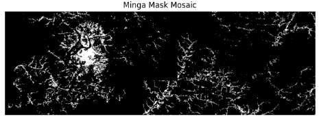
- Collect Sentinel-2 imagery for the target region.
- Load and rasterize the residential (housing) shapefile
- Stack the rasterized mask with the original imagery to form 4-channel images.
- Generate sliding-window patches (64×64).
- Split patches into positive/negative using historical wildfire coordinates.
- Train the CNN on the labeled pathces and run inference to produce riks predictions.
Inference
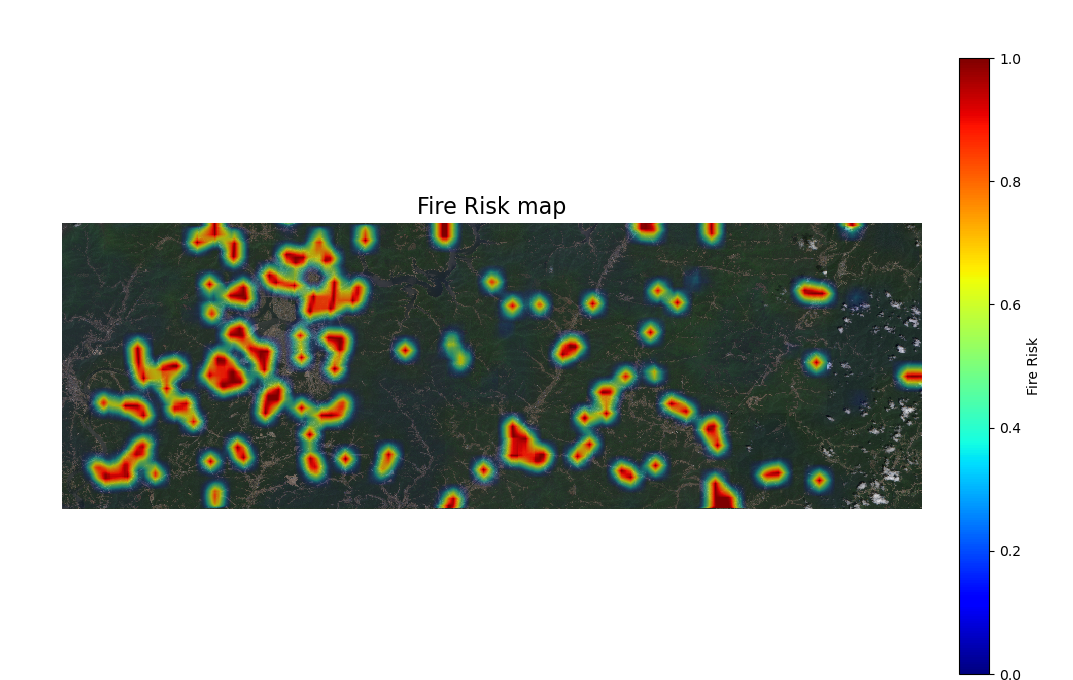
- Generated a heatmap from the model’s predictions.
Recall / Confusion matrix
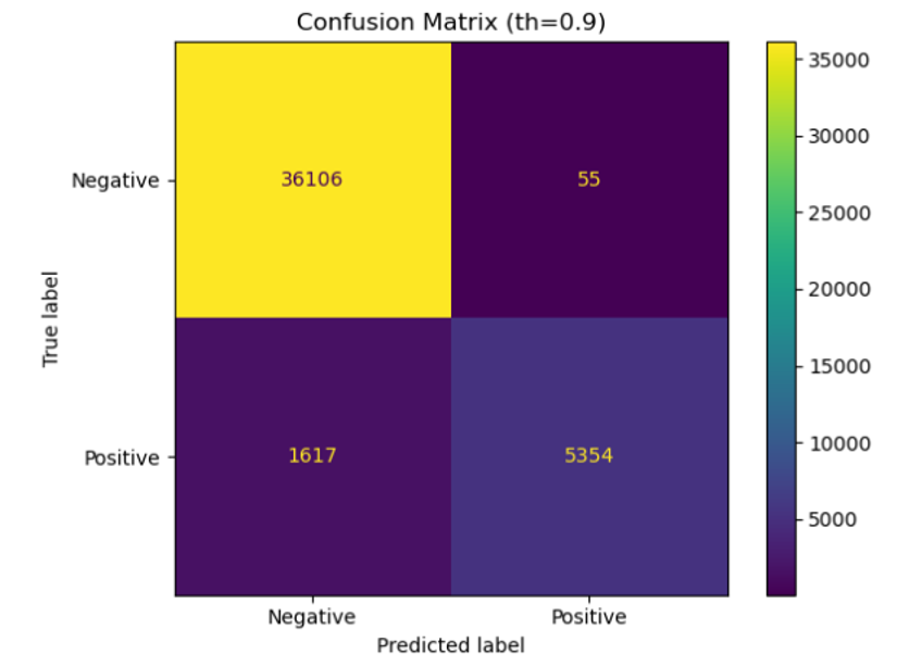
- Achieved a recall of 76.8% at a decision threshold of 0.9.
Planning
- Integrate additional human factors with environmental variables for better feature sets.
- Apply domain adaptation techniques to mitigate positive bias caused by data scarcity.